Spectrum Utilises the latest technology for remote sensing in environmental monitoring, including aerial data capture and drone survey services for Perth and throughout regional Western Australia

Contact usSpectrum Utilises the latest technology for remote sensing in environmental monitoring, including aerial data capture and drone survey services for Perth and throughout regional Western Australia
Contact usSpectrum Utilises the latest technology for remote sensing in environmental monitoring, including aerial data capture and drone survey services for Perth and throughout regional Western Australia
Contact us

TytonAI Practitioner
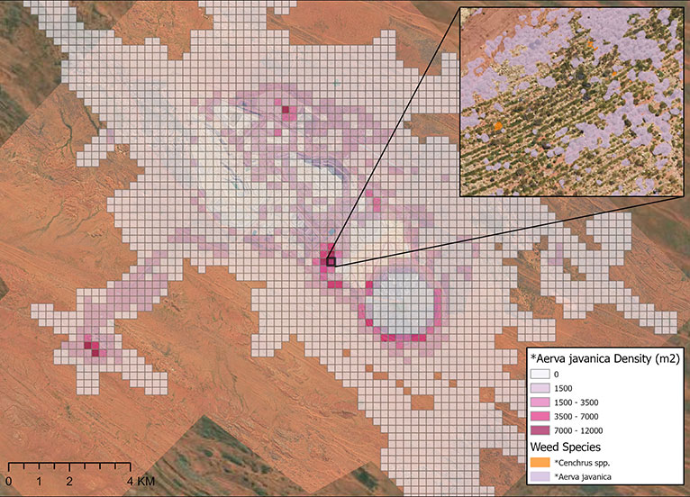
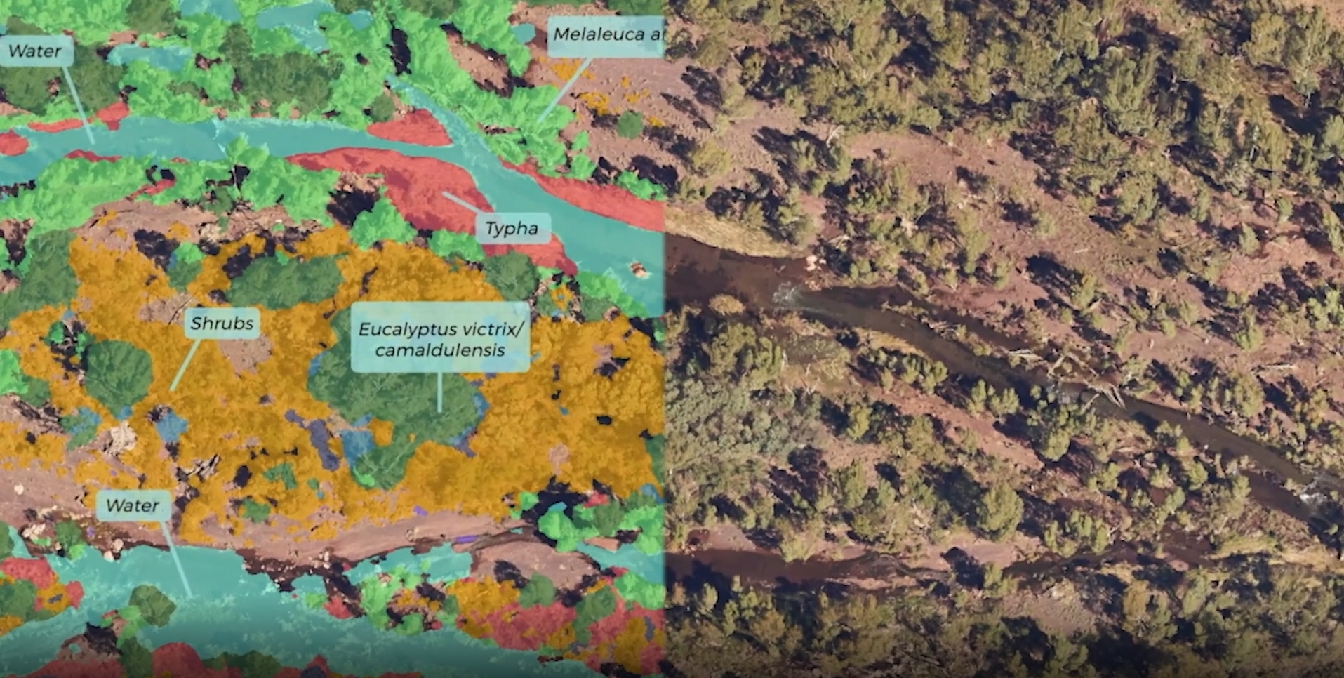
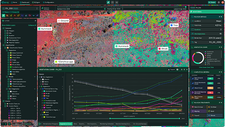
As a TytonAI practioner partner, we deliver whole-of-site ecological assessments at the individual plant scale, powered by Tyton’s AI. This enables fast, accurate vegetation, species, and landform classifications across large projects.

TytonIQ Consultant
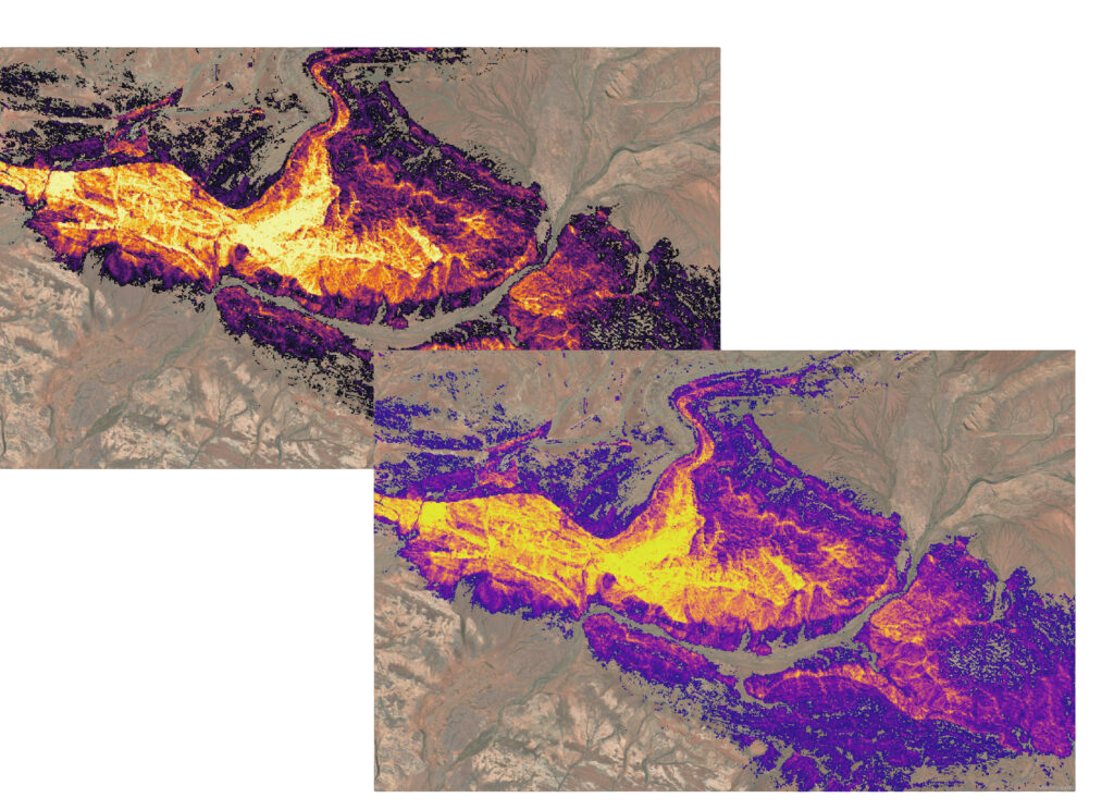
As a TytonIQ Consultant, we configure Tyton’s modular platform to align with rehabilitation targets, analogue sites, and best-practice standards. This ensures robust, transparent monitoring frameworks tailored to site-specific goals.